If you haven't checked it out lately, Google Maps ( http://maps.google.com ) added a new feature to it's mapping features called "Street View." Primarily in larger cities (like New York, Ft. Lauderdale, Orlando, Minneapolis, etc.) you can click on this new feature in the top right corner. When you click, blue lines appear on the map you are viewing to reveal a new feature. If you click on one of these blue lines, the view takes you from purely vertical (up and down) to a street level view (left, right, all-around). It even lets you move in for a closer look at things, and drive down the street with this feature on. You virtually can visit a city with this feature and look at things all around you. I recently traveled to St. Petersburg and was able to see the hotel from the street and all the neighboring sites. I also was able to see my birth home without spending a single cent in travel.
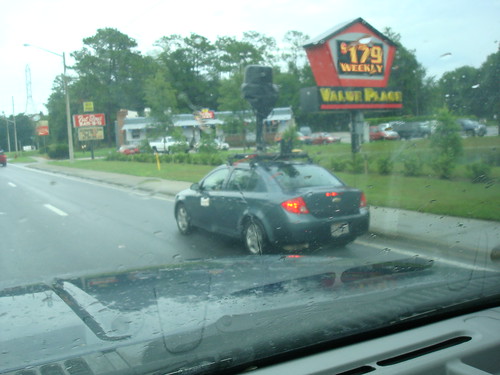
Anyhow, this picture is of the Google Maps cars as I caught it driving around my city. The weather was a bit wet so the camera was covered at this time, but this is the magic tool being used by Google to take over the mapping world (George Orwell would be proud!).
Wednesday, August 20, 2008
Google Maps Camera Car
Subscribe to:
Post Comments (Atom)
1 comment:
That was me driving the Google car around Ocala. I actually did about 1/3 of the state. I live in Silver Springs. It was a fun and interesting job. Too bad it was just a temp job.
Post a Comment